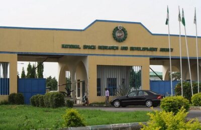
The recent remark made by the Director-General of the National Space Research and Development Agency (NASRDA), Dr Halilu Ahmad Shaba, on the use and importance of mapping and geospatial technology in the nation’s quest to defeat the menace of insurgency and terrorism presently ravaging some important parts of the country can never be overemphasized.
Timely and accurate information easily assessed and capable of being shared across our national security agencies, state and local political jurisdiction is fundamental to the decision-making capabilities of those tasked with the internal security mission of our country.
The insurgency and terrorism incidences witnessed over the years in the country has sparked the renewed interest by the national space agency, NASRDA, in the deployment of technologies to counter terrorists and insurgents. Monitoring and anticipating terror plans has become the key to staying ahead of the next insurgents attacks and this is where NASRDA is playing a key role.
Despite the definitions and dimensions of insurgency and terrorism changing over the years, geospatial information services, GIS, has been found globally to be an effective tool because it has the capabilities of preventing, predicting or countering insurgents attacks, while helping to strategize and support ground level combats operation. That is why NASRDA lead the way in developing it for our country.
The national space agency must be commended for making our country one of the nations in the world that has entrenched the use of mapping and geospatial technologies in its fight to rid the country of insurgency and terrorism. NASRDA has today helped in developing and found it expedient to use GIS applications to counter terror and has earlier postulated, it begins with monitoring and surveillance to predict the four components of WHEN, WHERE, HOW and WHO of terror activities.
It moves on to disseminate critical information through the various public services, internal security services and intelligence departments.

Mapping law enforcements report data can be an effective way to analyze where crimes comes occurs. The resulting visual displayed can be combined with other geographic data such as the locations of schools, parks and industrial complexes and used to analyze and investigate patterns of crimes and help inform responses by the security departments.
The past decade in particular has seen advances in analytical capabilities within the criminal justice communities, making it possible to add more geographic and social dimensions to statistical analyses to forecasts where crimes are likely to occur.
NASRDA has for long been researching on mapping and analyses. The agency has funded projects that explore, evaluate seed analytical techniques and technology to support law enforcements agencies that use place-based policing practices and strategies to help answer the questions often asked and that question is: How do we best as a country reduce insurgency and terrorism in our country and improve public safety?
The answer by NASRDA is simple and germane. It has solved the question by the agencies successful synergies with security agencies through it employment and deployments of mapping and geospatial assistance through information from those systems to the security agencies and this has revolutionized the security systems of our country in its fight against insurgency for good.
Geospatial technology has today, through NASRDA, been playing a crucial role in Nigeria as it has gone a long way to reducing the effectiveness of banditry and insurgency which has for long been disturbing the peace of the country. The demand for the services offered by the geospatial technologies for different applications such as utilities, transportations, defense and intelligence and others has grown significantly over the years.
Geospatial technology is an evolving area of interest that comprises remote sensing, global positioning system, and geographical information systems. Today, NASRDA is operating this system in the geospatial technology field to offer satellite imagery, aerial survey mapping services to obtain information about the earth’s surfaces which is used for further analyses and visualization.
The rising advancements and miniaturization of sensors have opened new prospects for geospatial data collection. The smaller versions of the existing systems for instance, mini satellites to drones which are equipped with various sensors are now allowing the security services to gather data that seemed impossible before thanks to the work of the NASRDA.
With the modernization of military intelligence technologies, the manner in which the wars on insurgencies are fought today has completely changed and transformed over the years and thanks to NASRDA, Nigeria is not left behind in the usage of the new innovations of mapping and geospatial technologies in its fight against insurgents.
NASRDA is today preparing our security agencies against insurgents strategies, advanced weaponry and the emerging virtual warfare, which makes the use of intelligence regarding the prediction and prevention of such movements just as crucial as on-the-ground warfare operations.
– Musa Wada writes from Abuja.


